“Glacier Dynamics and Changes in Ice Flow”
with Meredith Nettles

Originally presented 22 Apr 2012
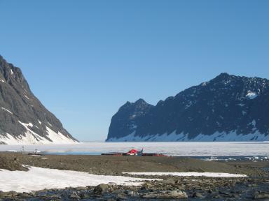
What really happens at the bottom of a glacier as it flows toward the sea? Meredith Nettles’s research focuses on tomographic imaging of the Earth’s upper mantle and studies of the earthquake source. Tomographic work includes the development of a robust and well-constrained model of the radially anisotropic, 3-D shear velocity structure of the upper mantle beneath North America. Current earthquake studies include an effort to constrain the source characteristics of glacial earthquakes and the processes that lead to those earthquakes. Prof. Nettles currently spends much of her time working on a major interdisciplinary geophysical observing campaign in East Greenland, at Helheim and Kangerdlugssuaq Glaciers.
Dr. Nettles is also co-PI of the Global CMT project, working to support and improve the routine analysis of moderate and large earthquakes worldwide, and to provide quality assessment for the Global Seismographic Network (GSN).
Introduction to this Workshop
View the introductory slideshow: Glacier Dynamics and Changes in Ice Flow
Cutting-Edge Research
Meredith Nettles
Assistant Professor of Earth and Environmental Sciences
Meredith Nettles’s research focuses on tomographic imaging of the Earth’s upper mantle and studies of the earthquake source. Tomographic work includes the development of a robust and well-constrained model of the radially anisotropic, 3-D shear velocity structure of the upper mantle beneath North America. Current earthquake studies include an effort to constrain the source characteristics of glacial earthquakes and the processes that lead to those earthquakes. Prof. Nettles currently spends much of her time working on a major interdisciplinary geophysical observing campaign in East Greenland, at Helheim and Kangerdlugssuaq Glaciers (see “Glacial Earthquakes”, below).
Prof. Nettles is also co-PI of the Global CMT project, working to support and improve the routine analysis of moderate and large earthquakes worldwide, and to provide quality assessment for the Global Seismographic Network (GSN).

View Dr. Nettles’ slideshow: Investigating Glacier Earthquakes
“Glacial Earthquakes Point to Rising Temperatures in Greenland”
Classroom Resources
TEA (Teachers Experiencing Antarctica Arctic) Activities
Is Greenland Melting? (SERC Earth Exploration Toolbook)
Draft of classroom activity based on Nettles and Ekstrom (2010)
Article
“Investigating Glacier Earthquake” activity pptx pdf
Other Resources for This Topic
Review of current understanding of glacial earthquakes:
Nettles, M., and G. Ekström, Glacial earthquakes in Greenland and Antarctica, Ann. Rev. Earth Plan. Sci, 38, 467-491, 2010.
link to article
Outlet-glacier response to melt-water input varies spatially and temporally during the melt season:
Andersen, M. L., M. Nettles, P. Elosegui, T. B. Larsen, G. S. Hamilton, and L. A. Stearns, Quantitative estimates of velocity sensitivity to surface melt variations at a large Greenland outlet glacier, J. Glaciol., 57, 609-620, doi:10.3189/002214311797409785, 2011. link to article
Geologic Survey of Denmark and Greenland
Greenland Tourism & Information
Images of Greenland taken by Lee Treloar (May 2010)
“Scientists Link Melting Glaciers to Earthquakes”
“Repeating Earthquakes on Mount Rainier–Are Glaciers the Culprit?”
“GlacierHub” (research/communities near glaciers/impact of retreats)
“Earthquakes Rattling Glaciers, Boosting Sea Level Rise”
Integrating Educational Technologies
General suggestions: Integrating Educational Technologies into Your Classrooms
Your assignment: Using GPS in Your Curriculum
1) What characteristics make GPS effective as a classroom teaching tool?
2) When should GPS-based activities be used for full-class instruction, and when should they be used for small groups or individual projects?
3) Describe strategies to locate suitable GPS-based activities for your classes.
and
4) Design a lesson plan that incorporates at least one GPS-based activity .
E2C Follow-up:
You may send your model lesson and other responses to this “assignment” to michael@earth2class.org. If suitable, we will post your work in the E2C lesson plans and/or add them to this section of the Workshop website.
Leave a Reply
You must be logged in to post a comment.